Arouca Municipality (Arouca)
 |
The entire territory of Arouca is "Arouca Geopark" which is a member of the European Geoparks Network and Global Geoparks Network on account of its outstanding geological heritage, educational programs and projects, and promotion of geotourism.
The territory that became Arouca was settled by vestiges of pre-historic tribes, but it was in the Roman occupation that the first artifacts associated with settlement first appeared. From archaeological excavations, it is known that the area was settled late in the Roman conquest of the Iberian Peninsula (due to its distance from coastal and north–south accesses). From local toponomy, the permanence of Germanic tribes is evident; names such as Sá, Saril, Alvarenga, Burgo, Escariz, Friães and Melareses, are examples of this influence.
Following Moorish invasion more information began to be recorded in this region. Christian settlements that existed within the area were abandoned during this time, and moved to other northern access points. These settlements later returned following the Reconquista, when instability in the region disappeared. The history of Arouca, therefore, only became available with the founding and growth of the Monastery of Arouca, culminating in the religious life of D. Mafalda, daughter of the second King, D. Sancho I. It was this monastery, which for many centuries, that the populace of the region depended. The monastery was erected in the 10th century, in the invocation of Saint Peter, by two noblemen: Loderigo and Vandilo, from Moldes. The primitive building was nothing more than a simple dwelling, supporting a complement of monks and nuns.
By the 12th century, D. Toda Viegas and his family became principal patrons of the monastery, resulting in a growth of wealth and prestige. D. Afonso Henriques, even before national independence, conceded the Viegas and the monastery's monks various privileges and donations. They received various charters between 1132 and 1143.
In the first years of the 13th century, the monastery of Arouca passed into the hands of the Crown, and D. Sancho I left the complex in his testament to his daughter D. Mafalda. She entered monastic life between 1217 and 1220. Her presence resulted in a period of splendor and importance, not merely for her presence, but also her material wealth, which she brought into monastic service. By this time, the monastery was a sanctuary for nuns, and the principal economic center of the Arouca valley. Following the death of D. Mafalda, in 1256, the prestige of the monastery continued, carried on by here former support, memory, religious and cult. She was beatified in 1792 and her remains placed in an urn, executed in ebony, crystal, silver and bronze in one of the wings of the monastery's church (where her body was later moved in 1793).
The municipality of Arouca evolved from a long process over the centuries, inheriting civil parishes and integrating municipalities from the 19th century. The municipality of Vila Meã do Burgo originated the parish of Burgo, which was annexed by Arouca in 1817. With the extinction of the municipalities of Alvarenga (1836) and Fermêdo (1855) many of the former parishes were integrated into Arouca: the parishes of Santa Cruz de Alvarenga, Canelas, Janarde and Espiunca were folded in from Alvarenga and the parishes of São Miguel do Mato, Fermêdo, Escariz and Mansores were annexed from Fermêdo. The parish of Covêlo de Paivó, which belong to the municipality of São Pedro do Sul, was annexed in 1917.
The historical centre of Arouca, which included many the current parishes was constituted by the seats of São Bartolomeu (in 1846 the parishes of São Bartolomeu de Arouca and Santo Estêvão de Moldes), Cabreiros, Albergaria da Serra, part of São Salvador do Burgo, Santa Eulália, São Miguel de Urrô, Várzea, Rossas, Santa Marinha de Tropêço and Chave.
Map - Arouca Municipality (Arouca)
Map
Country - Portugal
 |
 |
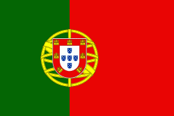
| Flag of Portugal | |
One of the oldest countries in Europe, its territory has been continuously settled, invaded and fought over since prehistoric times. The territory was first inhabited by pre-Roman and Celtic peoples who had contact with Phoenicians, ancient Greeks and Carthaginians. It was later ruled by the Romans, followed by the invasions of Germanic peoples and the Islamic invasion by the Moors, whose rule was eventually expelled during the Reconquista. Founded first as a county of the Kingdom of León in 868, gained its independence as the Kingdom of Portugal with the Treaty of Zamora in 1143.
Currency / Language
| ISO | Currency | Symbol | Significant figures |
|---|---|---|---|
| EUR | Euro | € | 2 |
| ISO | Language |
|---|---|
| PT | Portuguese language |


